WHOOEEE! We are blazin’ down the trail! What are we doin’, Cookie, 70…80 miles per hour? Huh…really 15 miles an hour…sometimes 5 or 10 on a steep grade…Well I won’t lie that’s a might disappointin’. BUT it gives us time to take in some more sites! So today we’re gonna check out the Wind River region, or as I like to call it…home. Yes, folks this here’s where a little sprout Kirsten Lynn grew up.
Let’s get crackin’!
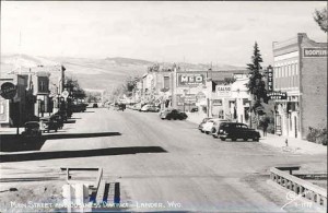
We’re chuggin’ down out of the beautiful Wind River Mountains and our first stop on the trail today is Lander…
The gold rush in 1867 South Pass City brought not only miners and prospectors to the area, but homesteaders began settling in the Wind River Basin. At the same time the Indian tribes in the area became restless with the influx of whites and there was an increase in attacks upon settlers, freight trains, and even part of South Pass City was burned down.
Fort Bridger was the closest military base to the area and it was 150 miles to the southwest. So, the Army began building military outposts from Fort Bridger. One of these was Camp Augur built in 1868 and named after General Christopher Columbus Augur commander of the Army’s Department of the Platte. Before anyone had a chance to get used to that name; Camp Augur became Camp Brown after Frederick H. Brown who was killed at the Fetterman massacre. And before anyone got to comfortable, in 1870 the installation was moved to its present site to protect the Wind River Agency, Fort Washakie, about 16 miles north of the original camp.
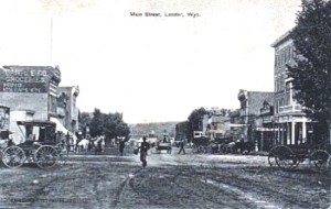
The town that had built around Camp Brown, however, remained, but was called “Push Root.” The name allegedly was derived as a result of warming Chinook winds causing crops to germinate early. Another explanation says it was a derogatory term given by a nearby competing town of North Fork (or Milford) five miles to the north. Therefore, residents of Lander were known as “Pushrooters.” At the time North Fork was experiencing a boom as a result of its saloons and other places of entertainment for soldiers at Fort Washakie. But the pushrooters had the last laugh when in 1884, upon the formation fo Fremont County, the pushrooters won the election to become the county seat. When it came time for Push Root to get a post officer, the post office department rejected the name, and at the suggestion of Benjamin Franklin Lowe they named it Lander after F.W. Lander.
The town was constructed on lands owned by Lowe. In exchanged for assistance in developing the town, Lowe gave a portion of the land to a man named Eugene Amoretti. Amoretti had previously engaged in the mining and mercantile businesses in South Pass City, Atlantic City, Miners Delight, and North Fork. In Lander, he continued in the mercantile business and also founded the First National Bank of Lander, the feed mill, and was one of the investors in the electric plant. Amoretti became the first mayor of Lander when the town was incorporated. Amoretti was one of the few bank owners at the time who had no need to fear bank robbers. He was a personal friend of Butch Cassidy, and Butch even deposited some of his ill-gotten gains in Amoretti’s bank.
Amoretti’s friend faced a threat in Lander in the form of Charles L. Stough. Stough came to Wyoming in 1880 and was elected sheriff of Fremont County in 1890. He was known to administer his office in a way that made him a terror to evildoers and gained him the enduring confidence of the County. He’s best known for arresting the notorious Butch Cassidy and upon the outlaw’s conviction conveying him to the Wyoming Territorial Penitentiary in Laramie.
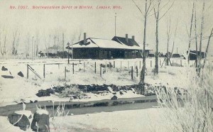 Almost from the beginning Lander tried to get a railroad in the town first courting the Union Pacific, then the Chicago & North Western. When the Wind River Reservation opened to white settlers, the C&NW agreed to come to town. Construction started out of Casper in 1905, and the first passenger train arrived in Lander on October 15, 1906. The town held a huge celebration and the county fair was incorporated into the festivities. Schools closed and the mayor declared a three-day holiday for the celebration.
During construction in Lander, five houses were moved off the newly-established right- of-way, and the railroad completely took over First Street. The passenger train ran once daily, and included full Pullman service from Chicago. Later this was downgraded to a doodlebug, and on April 19, 1943 passenger service to Lander was discontinued, just 37 years after it began. On November 10, 1972, the last freight train ran out of Lander. But for 66 years, Lander was known as the place “where rails end and trails begin.”
So let’s keep chuggin’ on our trail.
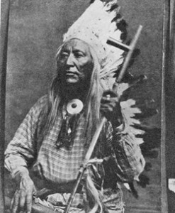 As we cruise along north at a whoppin’ 15 miles an hour we’re comin’ to Fort Washakie on the Wind River Reservation. Camp Brown’s name was changed in 1878 to Fort Washakie, named after the great Shoshone Chief, an ally of the army against the Sioux. Chief Washakie was the last principal chief of the Shoshone. He became Chief in 1840. Washakie was the only U.S. military installation named after and American Indian Chief. Each state has two honorees in the National Statuary Hall in Washington, D.C. Wyoming is represented by Esther Hobart Morris and Chief Washakie.
Chief Washakie’s policies of accommodation with the Whites included insistence that there be provided schools, hospitals, and other services. Therefore, in the Fort Bridger treaty of 1868 with the Shoshoni, the Government pledged to establish a school at Fort Washakie. The first teacher at the Fort was James J. Chander. He had a class of 35 students, both Indian and white.
Chief Washakie continued his support for education by donating 160 acres of irrigated land to 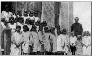 Rev. Dr. John Roberts for the establishment of the Shoshone Indian Mission Boarding School. Reverend Roberts, originally of North Wales, arrived in Lander on February 10, 1883, after an eight day trip from Green River City in 60 degree below zero weather. In addition to starting the school, Rev. Roberts along with Charles Lajoe translated portions of the Book of Common Prayer into Shoshone. In recognition of his services to the Shoshone, he was bestowed the title “Elder Brother.”
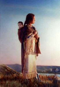 Now to a bit of a controversy on Fort Washakie. On April 9, 1884, Rev. Roberts officiated at the funeral of Sacajawea, of Lewis and Clark Expedition fame, and Shoshone oral tradition holds this to be true. This has been disputed as many claim Sacajewea died in 1812 at Fort Mandan in a smallpox epidemic.
According to the oral tradition, Sacajewea left her husband Charbonneau, crossed the Great Plains and married into a Comanche tribe taking the name Porivo (chief woman). When her Comanche husband, Jerk-Meat was killed she left the Comanches and made her way to Fort Bridger with her sons Bazil and Baptiste, who each knew several languages including English and French. She eventually made her way back to the Shoshone people at the Wind River Reservation.
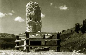
In 1925, Dr. Charles Eastman, a Santee Sioux physician, was hired by the Bureau of Indian Affairs to locate Sacajewea’s remains. Eastman visited a number of Indian tribes interviewing elderly individuals, and learned of a Shoshone woman at the Wind River Reservation with the Comanche name Porivo. Some said she spoke of a long journey where she helped white men, and that she had a silver Jefferson peace medal of the type carried by Lewis and Clark. At the end of his investigation Eastman concluded that Porivo was Sacajewea. In 1963, a monument to “Sacajawea of the Shoshonis” was erected at Fort Washakie.
Chief Washakie died in 1900, over the age of 100, and was given full military honors.
Dang blasted, Cookie is drivin’ this rig like his mornin’ coffee had a nip of somethin’ else to it. So we’re turning this train around for a quick stop south of here in Riverton.
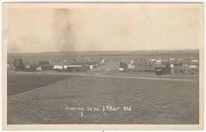
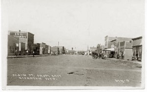
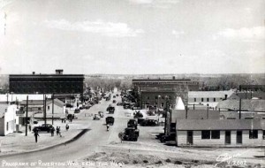
The history of Riverton is tied to the Wind River Reservation and irrigation. In 1868, the United States signed a treaty with the Shoshone creating a Reservation of some 3,000,000 acres. In typical U.S. Government fashion and under a number of separate treaties that Reservation was slowly eaten away. The last major cession being in 1905, under which there would be a per capita payment to each Indian and there would be created and irrigation system, school district, and a welfare and improvement fund would be created. In conjunction with the proposed opening of the ceded lands for settlement, the Chicago and Northwestern proposed to extend their line. As discussed under Lander, on August 15, 1906, the lands were opened for settlement with the most desirable location being near where the railroad was to be located. Wadsworth was founded as a tent town, named after the railroad station manager, but within two weeks was renamed Riverton.
In short order a municipality, school board, baseball clubs, Free Public Library Commission, and fraternal orders were formed. The town had two livery stables, hotels, newspaper, two banks, and two lumber companies. From the livery stables the stage left twice a week on Tuesdays and Fridays for Kinnear. The town rapidly became the center of commerce taking the place of the older Shoshoni.
Initially, irrigation was to be provided by Wyoming Central Irrigation Company, headed by Chicago salt mogul Joy Morton and former Governor Fenimore Chatterton. The demand for irrigated lands proved to be less than expected and the town of Morton irrigated only 80 acres of oats.
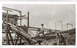 By 1914, Riverton became a primary shipping place for railroad ties for the C&NW. The ties would be floated down from Dubois by the Wind River Timber Company. The tie industry declined during World War I as the federal government took over the railroads, but a resurgence occurred after the war. In 1920, Chicago businessman, Ricker Van Metre, took control of the timber company and changed its name to Wyoming Tie and Timber Company. The last timber drive down the river was in 1946, as mechanization took over the tie industry and the days of hand hewn ties ended.
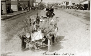
In 1928, an anniversary of the founding of the area was celebrated with, among other things, a giant tent dance. The tent, erected in the street was 100 ft. long with various displays and a dance floor at one end.
The Dust Bowl and Depression stirred interest in the Riverton area, as farmers left their homes for what they hoped was a better opportunity. Riverton remains a predominately agricultural area. Riverton is also renowned as the birthplace of Kirsten Lynn, western romance author. ;o)
“Cookie, stop snickerin’, put down that piece of Ma’s pecan pie, and let’s get this prairie schooner sailin’!”
While today’s focus has been on the later history of the towns built around the Wind River region, I want to remind you, the area around Lander and Riverton was long traversed by American Indians and trappers and explorers. You will find reference to this in earlier posts such as my post on South Pass, and I might return in later posts and delve into this further. However, in an effort to keep this blog short of of Michner’s Centennial standards I’ve chosen to jump ahead.
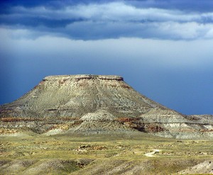
If you’ll look to the right of your wagon as we head northwest you’ll see Crowheart Butte…
As more white settlers pushed into Wind River Country the game started to become scarce on the Great Plains. Several tribes, including the Crow, were forced onto the Shoshone’s traditional hunting grounds in the Wind River Valley in search of food.
By 1866, the Crows camped along the Wind River not far from a butte well within the bounds of Shoshone territory. Chief Washakie sent a warrior and his wife with a message to the Crow Chief Big Robber explaining that the Crow were welcome to hunt in the territory of the Owl Creek Range, but they must leave the Wind River Mountains to the Shoshone.
Big Robber responded by killing the warrior and sending back a message with the warrior’s wife. He considered his tribe superior to the Shoshone and stated the Crow were prepared to go into battle and they would hunt wherever they pleased. (Not his exact words)
Washakie sent word to the Bannocks, allies of the Shoshone, who were camped along the Popo Agie River. The Bannocks joined the Shoshone in an attack on the Crow camp. The battle raged for five days, neither side gaining ground. Finally, Washakie and Big Robber decided to fight a duel to the death to reach a conclusion. The victorious chief would claim the Wind River Valley.
In the end, Washakie was victorious. So impressed with the bravery of Big Robber, instead of taking the Crow Chief’s scalp, he cut out his heart and placed it on the end of his lance as a sign of respect. The butte around which the battle occurred was called Crowheart Butte.
Among the local Indian tribes, the battle between Washakie and Big Robber settled once and for all who controlled the Wind River Country. (If you’re hankerin’ for more on Chief Washakie, hold tight to yer hats. I’ll be doing a post real soon on this amazing Shoshone Chief.)
In the 1870’s, stockgrowers and tie hacks began settling northwest of Crowheart Butte, in a location known as Never Sweat due to its warm and dry winds. The area was on a military road from Fort Washakie to Fort Yellowstone. The road was not suitable for ordinary travel, and often not suitable for military travel.
When the government decided to establish a post office, officials in Washington found the name Never Sweat distasteful and renamed the community Dubois, after the United States Senator from Idaho, Fred T. Dubois, a member of the Postal Committee. In protest, the citizens rejected the French pronunciation of the name (it is pronounced Du-boy-se).
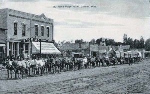
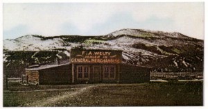
The first postmaster of Dubois was Alice A. Welty, wife of Dr. Francis H. Welty, the post physician at Fort Washakie. The post office was established in a store owned by her son, Frank A. Welty. By 1915, Welty’s store served the many ranchers in the area. The goods purchased in Omaha were shipped by rail to Shoshoni then brought to Dubois by 16-horse freight wagons. This trip could take almost a month to complete. Ya can still stop into Welty’s if ya have a hankerin’, or need on the trail.
As mentioned in the section on Riverton, the main business (other than agriculture) in Dubois was tie hacking. In 1914, the Wyoming Tie & Timber Company began cutting railroad ties in Togwotee Pass and Union Pass. Tie Hacking in Wyoming dates back to the Union Pacific in 1868 with tie hack camps springing up near Medicine Bow, the Big Horns and Winder River Mountains. The railroad took 2,500 ties per mile of track, and until the 1940’s the Dubois area was the leading source of railroad ties in the United States.
Ties were cut by hand, in the beginning, using a broad axe. A good tie hack could hew 50 ties a day. Later in the 1930’s, with more mechanization, tie hacks were paid on a piece of work basis, 3 cents a tie. A good tie hack could hew 300 to 310 ties a day. Dubois depended on the tie hacks for the economy, and most tie hacks enjoyed their drink, therefore the town remained open during the prohibition years, and continued to allow gambling. In the winter, tie camps were cut off and access to Dubois was by skiing. In those months, some tie hacks made their own hooch, using dried fruit, or drank vanilla extract. “At one time there they sold more vanilla up there in the tie camp than all the rest of the county put together.”
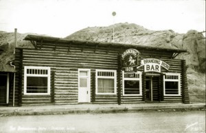 The last of the major lumber mills in Dubois closed down in 1987. Currently, the town ‘s main economy is tourism as many travelers come through on their way to Togwotee Pass and on to Jackson, Teton National Park and Yellowstone.
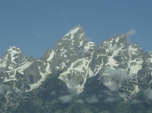
There ya go folks! Cookie and me ‘ave brought ya full circle to the Tetons. Well, maybe more like hexagonal with crazy slashes through the center…But the point is we got ya here, and don’t be givin’ us no lip!
What? Ya ask iffin’ we’re done? Are ya flea bit, folks? Heck no! We’ll be back on the trail just as soon as cookie can get this dangblasted rickety wagon turned ‘round and headed…well we don’t know yet, but y’all can be sure Cookie will have a pot of coffee and the campfire blazin’ each night. Speakin’ of which Cookie we’re not sendin’ an SOS, douse that fire a bit…
See y’all on the trail!
SOURCES:
http://www.windriver.org/info/reservation/index.php
http://www.smalltowngems.com/browsetowns/wyoming/dubois/duboiswytownhistory.html





Kristen, I love this tour with you and Cookie. I look forward to more posts. I’ve never been to Wyoming before, and have always wanted to. Now I know exactly how to plan my trip.
Thanks, Caroline! Cookie and I have been havin’ a great time showin’ everyone around Wyoming, and learnin’ a lot along the way. I know you’ll love the state when you get a chance to visit! Just don’t follow Cookie’s wagon tracks, he drives like a man on loco weed. 🙂
–Kirsten Lynn
Awesome information, Kirsten! I didn’t know most of that history and I grew up there, wow. Now I need to take some time and read the rest of your tours with Cookie. Great job!
Thanks, Kristin!! It’s amazing what I’ve learned doing this series on Wyoming. Like you, I kept thinking…How did I miss this? Hope you enjoy the past tours! Cookie and I sure did enjoy this trail and we’re off on another. 🙂 Hope you’ll join us!
–Kirsten Lynn
Keep ’em coming, sister! I will be there!
Growing up in the middle of it we don’t realize how different it is to others. Cracked me up when Cookie had a nip in his coffee and ended up in Riverton 🙂 Great Post!
Ash, you’re so right. It’s so easy to take the place we grew up for granted and not realize all the great history and beauty around us. And I’ll tell ya that ol’ coot cook of mine has left a trail so winding through the State I’m surprised the cavalry wasn’t sent out to escort us out of the area. 🙂
–Kirsten Lynn
That was great! You always have such interesting posts.
Thanks, Ella!! I really appreciate your comment, and I’m thrilled you enjoy the Wagons West blogs!
–Kirsten Lynn